
Lee Pearson: nineteen years in the same district
He started with water systems and half-built community infrastructure, spent a decade on the economics of agricultural risk, and came back to the question underneath both — what is land actually worth, and to whom.
In April 2007 Lee Pearson flew into Entebbe five days ahead of his team. He was an undergraduate civil engineer, president of Duke's Engineers Without Borders chapter since 2006, and the chapter had two projects in Uganda: a water resource project in Kasaka, and a resource centre in Nkokonjeru. He went early to meet the man on the other end of the correspondence — Ignitius Bwoogi, director of the Rural Agency for Sustainable Development. By late 2006, Bwoogi had listed Lee as a professional referee on his own CV.
Bwoogi took him to see the resource centre. It was a shell. Brick walls to sill height, no roof, grass growing inside the footprint. Construction had stopped, and not for an engineering reason: vanilla and coffee prices had fallen, RASD's income had fallen with them, and the building had stopped where the money stopped.
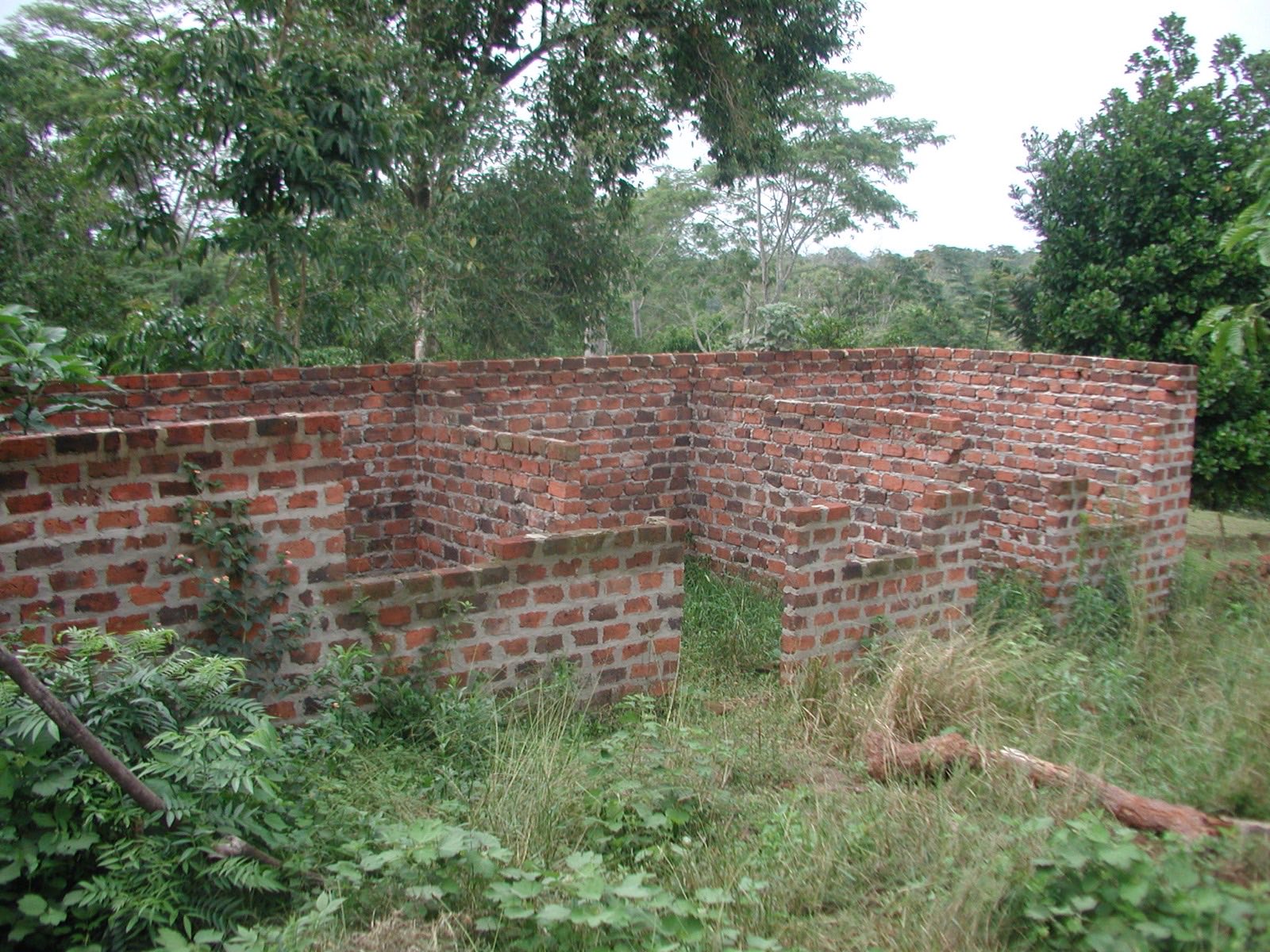
A half-finished wall is not an engineering failure. It is a commodity price, arriving late, in brick.
He had come to build something. What he was actually shown was a balance sheet.
The notebook, not the pipe
The same year, an Engineers Without Borders project took him to Peru. The photograph below is the part of that work that turned out to matter. Not the tap, and not the pipe — the notebook.
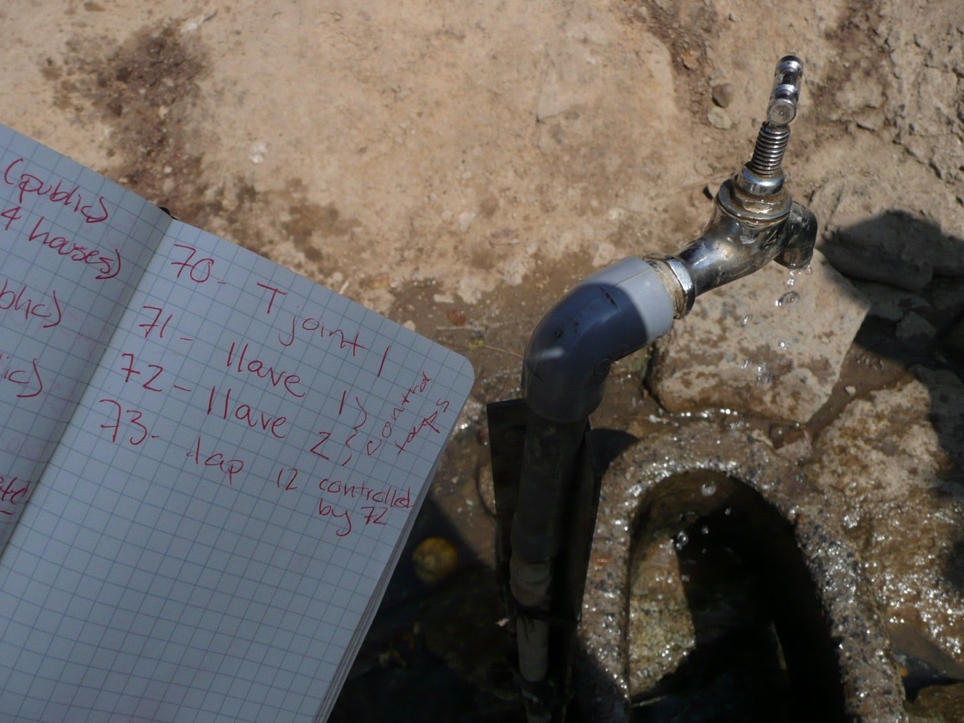
Seventy, a T joint. Seventy-one and seventy-two, valves. Seventy-three, a tap controlled by seventy-two. A water network is only as reliable as the record of what is connected to what, and that record is made by one person walking the line and writing things down in order. The hardware is the easy part. The survey discipline behind it is the thing that either exists or does not — and it is the same discipline that decides, today, whether a project boundary survives being walked.
Four years on the other side of the ledger
From 2009 to 2013 he was at Engineers Without Borders UK, first as Placement Manager and then as Finance Coordinator, running the charity's finances. The part worth reporting is not the title. He established an annual placement: British volunteers going out each year to that same Ugandan NGO, to work on coffee farmer incomes.
A one-off build is funded once. A recurring placement has to be budgeted, staffed and defended every year against everything else the money could do. That is a different kind of commitment, and it teaches the cost that nobody puts in a project model — the cost of continuing to turn up. In this business it is usually the cost that decides whether anything gets finished.
Going back to measure it
In December 2013 he went back, this time with Neil McRoberts of UC Davis's Department of Plant Pathology and with Bwoogi, on a UC Davis SEED grant. They surveyed coffee growers and traders across Buikwe, Mukono and Kamuli. The instruments say what the question had become by then:
- GPS tags on farms, so that a grower's answers attach to a location rather than to a name on a list.
- A ranking exercise setting coffee wilt disease against twig borer — not which is worse in the literature, but which a grower treats as worse.
- A risk-aversion elicitation, because what a household will plant depends on what it can afford to lose.
- A map of advice networks: who a farmer actually takes advice from, which is rarely the person an extension programme assumes.
In January 2014 he and Bwoogi presented the results at Imperial College London.
Read that list again with a carbon or agroforestry project in mind. Location you can defend, the risk a grower perceives rather than the one the model assumes, the loss a household can absorb, and the people whose word actually moves a decision. That is most of what determines whether a land-use commitment holds for decades, and almost none of it is visible from orbit.
The economics of things going wrong
He finished at Duke in 2008: civil engineering, cum laude, with distinction in the department. What follows looks on paper like four separate fields. It is one question asked four ways — what does it cost to reduce a risk, and who ends up paying for it?
An MSc in Ecological Economics at Edinburgh, with distinction. An MPhil in Engineering for Sustainable Development at Cambridge, carried out with the Water Industry Commission for Scotland — the economic regulator that sets what Scottish Water may charge. A Fulbright year at the Australian National University running panel econometrics on sanitary and phytosanitary trade barriers: the rules that decide which produce may cross which border, and what compliance with them costs the people growing it. Then a PhD at Imperial College London's Centre for Environmental Policy on risk mitigation measures in agricultural trade, supervised by the late John Mumford and by Yiannis Kountouris.
Trifinio, 2008–09 to 2012–13
For CABI's coffee and climate work he built farm-level cost, yield and income data across the Trifinio region where Guatemala, Honduras and El Salvador meet, covering coffee years 2008–09 to 2012–13, and modelled how drought, leaf rust and berry borer moved those numbers.
The series runs straight into the year the abstraction ended. The International Coffee Organization's report to its Council (ED 2157/13, 13 May 2013) recorded the 2012/13 leaf rust outbreak as the worst since the pest first appeared in Central America in 1976: on PROMECAFÉ's figures, more than 50% of the region's coffee-growing area affected, incidence of 74% in El Salvador, 70% in Guatemala and 25% in Honduras, and total regional damage of about 2.7 million bags, or roughly US$500 million. FEWS NET later put El Salvador's production down 70% between the 2010/11 and 2013/14 seasons and Guatemala's down 18% between 2011/12 and 2013/14 (The impact of the coffee rust outbreak on the coffee sector in Central America, 31 May 2016).
Building the cost and income lines for farms in exactly those three countries, right up to that year, is a particular education. It shows you how far a model built on averages sits from a grower's actual year — and that the difference between the two is not noise. It is the whole risk.
San Francisco, 2013
The same year as that Uganda survey, he spent a stint at Boston Consulting Group in San Francisco: financial modelling for a wood products manufacturer, and benchmarking a corporate venture capital unit. No amount of survey work teaches what that teaches, which is how people who allocate capital actually decide, and which evidence they treat as load-bearing rather than merely thorough.
It also puts a forest and a wood-products P&L on the same page, which is roughly where this firm ended up.
The same question, from the other end
He went on to found Wovoka, the project developer this advisory grew out of. The work now is the stage before a project exists. A feasibility assessment of around 1,200 hectares of abandoned fishponds that found 39 hectares ecologically viable, on hydrology, species and habitat matching, soil and salinity screening and historical land-cover analysis — and advised against planting the rest. Multispectral drone survey across upland and coastal sites, and the vegetation indices, land-cover classification, hydrological and topographic overlays and coastal-to-upland delineation built from it. Biodiversity baselining with field survey, camera traps and acoustic loggers. The unglamorous tenure and consent groundwork that decides whether any of it can be built on.
And vanilla. An agroforestry pilot in Uganda that became a trading business, Buji Vanilla — because the argument he was handed in 2007 still holds. A landscape that cannot pay for itself does not stay restored, and a building stops where the price stops.
Ignitius Bwoogi sits on this firm's advisory board. The Ugandan vanilla work runs through RASD, in the same district, nineteen years on.
If you are looking at a landscape
The question he is still interested in is the one from Nkokonjeru: what is this land actually worth, to the people who hold it, and what would have to be true for that value to be realised rather than extracted. If that is the question in front of you — before a hectare target is set, while the answer can still change — write to him directly.